US 34 and Taft Avenue Intersection Improvement Project

Share US 34 and Taft Avenue Intersection Improvement Project on Facebook Share US 34 and Taft Avenue Intersection Improvement Project on Twitter Share US 34 and Taft Avenue Intersection Improvement Project on Linkedin Email US 34 and Taft Avenue Intersection Improvement Project link

The US 34 highway managed by the Colorado Department of Transportation (CDOT) is a regionally traveled road. In addition to serving as a main corridor for Lovelanders, it also heavily used by visitors and guests as the gateway to Rocky Mountain National Park.

According to the City’s traffic data, US 34/Eisenhower Boulevard has 28,000 daily commuters and 21,000 Taft Avenue commuters daily. With this information, as well as how many collisions occur through this heavily congested area, the City has worked to improve traffic flow and reduce congestion at one of Loveland’s busiest intersections.

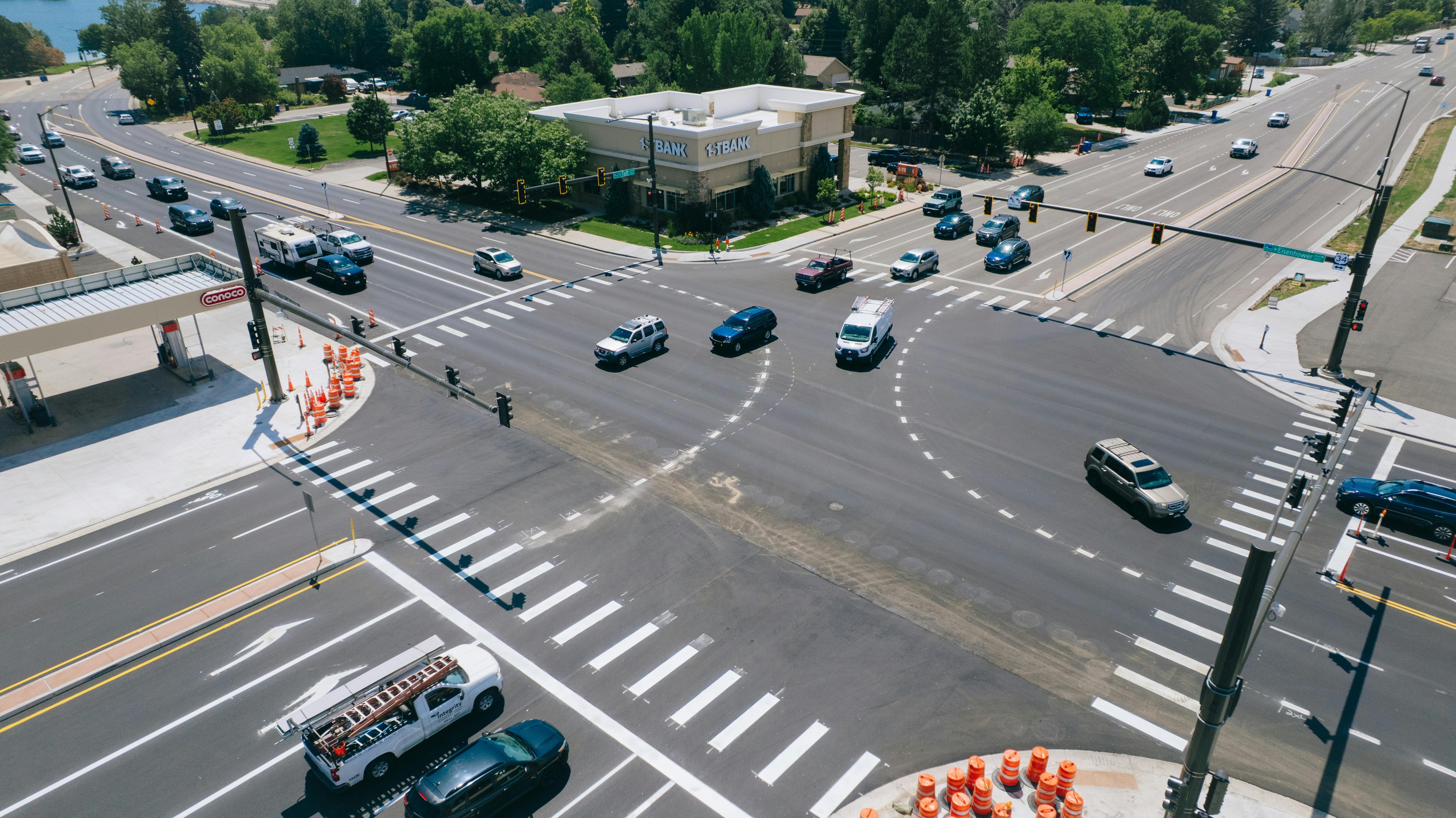
Once complete, the US 34 and Taft Avenue Intersection Improvement Project will improve the intersection by providing:

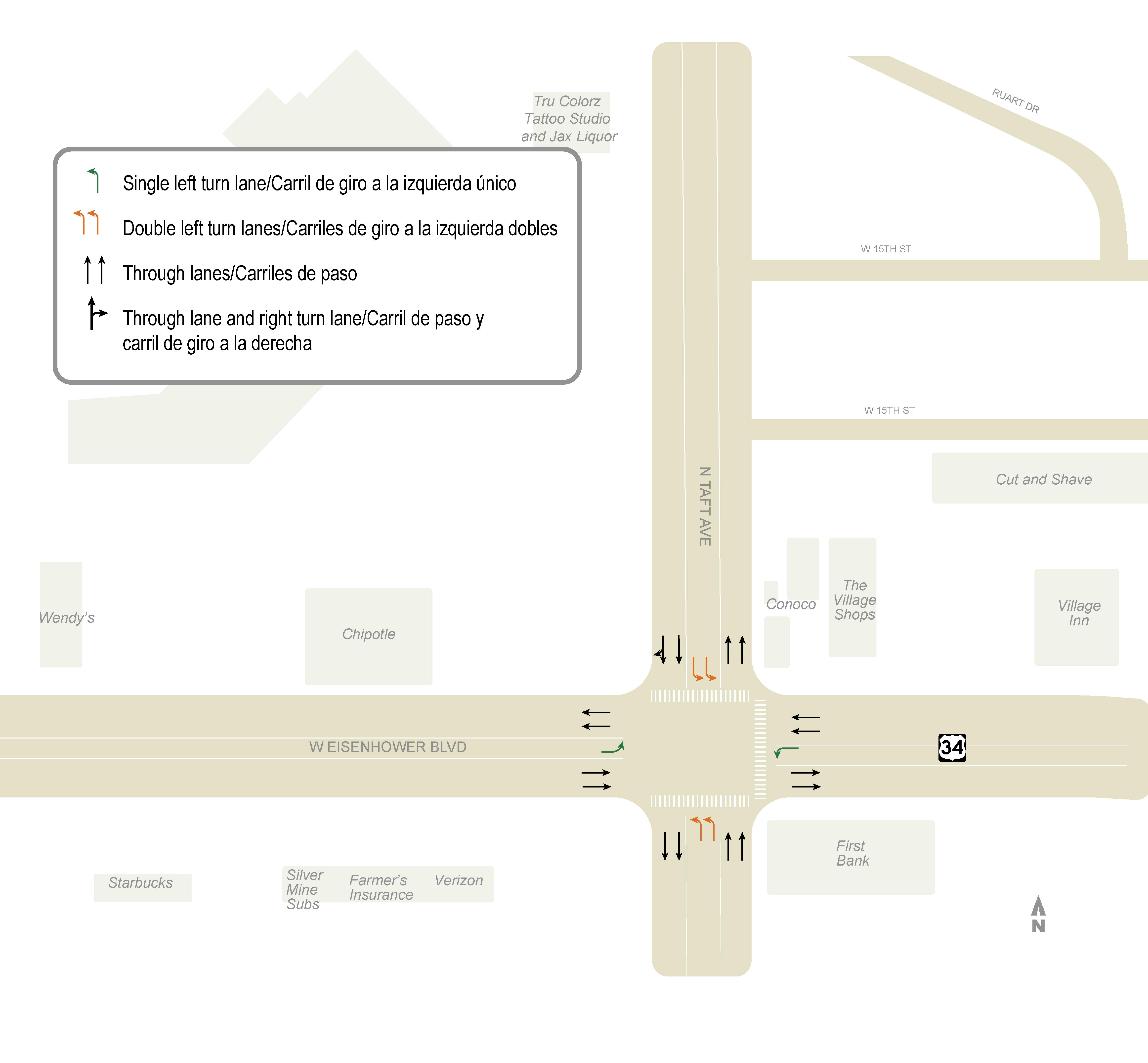
  1. Two through lanes of traffic in each direction on North Taft Avenue (north and southbound).
  2. Double turn lanes
  3. Bike lanes, curb, gutter, and sidewalks to promote pedestrian and cyclist safety.
  4. An updated traffic signal at the US 34 and North Taft Avenue intersection, meeting current industry standards.
  5. Water and electric infrastructure enhancements to accommodate future utility demands.

This work will provide safer conditions on North Taft Avenue and the US 34/Eisenhower Boulevard intersection, as well as improve a multi-modal (walking, biking, driving and public transit) corridor along North Taft Avenue that’s part of the City’s larger Connect Loveland Master Plan.

Some history

The US 34 and Taft Avenue Intersection Improvement Project was introduced to the Loveland City Council in 1999. Throughout the years, the biggest hurdle for the project has been funding. The City found different funding sources to move the project forward over the years and is now able to move forward with allocated funding dedicated to the project. The City has acquired the homes along North Taft Avenue from 11th Street to Westshore Drive for the project, starting in 2021. In order to accomplish the improvements to widen Taft, additional rights-of-way and easements were required. The City acquired these properties to meet construction schedules and progress with an anticipated summer 2024 construction date—all of which is necessary to leverage federal grant funding opportunities.

Why now?

The project must start this summer to meet construction schedules and leverage federal grant funding opportunities.

What's next?

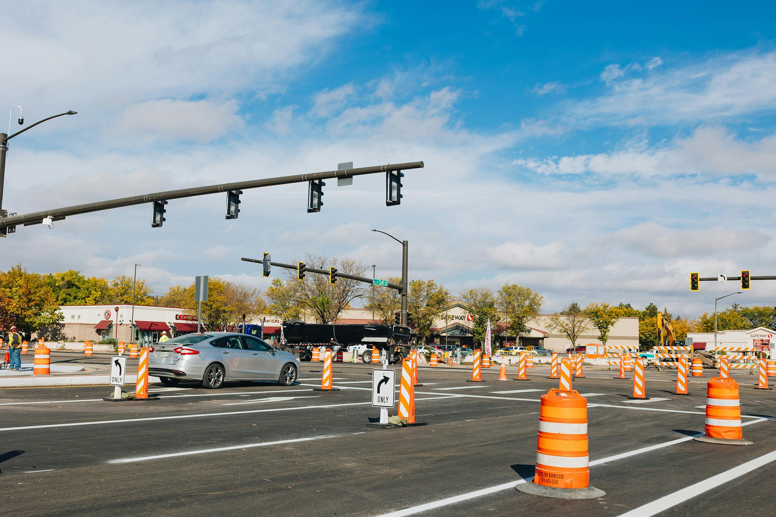
The Taft Avenue demolition work and gas line relocations have been completed. Construction Phase 1 will start on Monday, July 8, weather-dependent. Before this date, the City will begin staging the area along S. Taft Avenue with construction equipment and materials. This project will entail four phasing stages. An overview of the phases is shown on the right sidebar under " Project Timeline" or "Documents."


Why are we doing this project?

After reviewing the crash data, including this area into Connect Loveland and reviewing the multi-modal accessibility of the intersection, the City looks forward to incorporating these much-needed improvements to one of Loveland’s busiest intersections.

How will this be funded?

The project will be supported by multiple funding streams collected over the past 10 years to move the project forward (2013-2023):

  • Congestion Mitigation Air Quality Grant = $3,330,637
  • TABOR Excess = $100,000
  • General Fund = $2,220,829
    • Allocated funds dedicated from 2021 - 2023.
  • Capital Expansion Fees (CEF)= $2,935,828
    • Developer fees dedicated to improving infrastructure for future expansion.

Stay Informed

To stay informed about this project, subscribe to our email list in the "Stay Informed" section. We understand construction can cause disruptions. Contact our project email at taftus34improvement@getinfonow.us or the hotline at 970-599-7788. Our team will respond to your concerns, comments, or questions within 24 hours. Thank you for your patience while this work is being completed.

Questions and Answers

Have a question about the project? Ask it below and we'll follow-up shortly!

loader image
Didn't receive confirmation?
Seems like you are already registered, please provide the password. Forgot your password? Create a new one now.
  • Share What is the approx. end date to the project on Facebook Share What is the approx. end date to the project on Twitter Share What is the approx. end date to the project on Linkedin Email What is the approx. end date to the project link

    What is the approx. end date to the project

    Barry R Frost asked 2 months ago

    Hello, thank you for your question. We are projecting a late spring 2025 completion date. As the project enters Phase 3 and we pause for the winter months later this year, we can provide a firmer completion date. Please visit our page weekly to get the latest updates about the project. Thank you!

  • Share There is a map on letstalkloveland.org which shows the traffic detours. The map has a large light blue area extending from west of Wilson to about the middle of Lake Loveland, and from the top of the map to below Eisenhower. What is this supposed to represent? Also, on the same map, Van Buren is labeled as Buren Ave. on Facebook Share There is a map on letstalkloveland.org which shows the traffic detours. The map has a large light blue area extending from west of Wilson to about the middle of Lake Loveland, and from the top of the map to below Eisenhower. What is this supposed to represent? Also, on the same map, Van Buren is labeled as Buren Ave. on Twitter Share There is a map on letstalkloveland.org which shows the traffic detours. The map has a large light blue area extending from west of Wilson to about the middle of Lake Loveland, and from the top of the map to below Eisenhower. What is this supposed to represent? Also, on the same map, Van Buren is labeled as Buren Ave. on Linkedin Email There is a map on letstalkloveland.org which shows the traffic detours. The map has a large light blue area extending from west of Wilson to about the middle of Lake Loveland, and from the top of the map to below Eisenhower. What is this supposed to represent? Also, on the same map, Van Buren is labeled as Buren Ave. link

    There is a map on letstalkloveland.org which shows the traffic detours. The map has a large light blue area extending from west of Wilson to about the middle of Lake Loveland, and from the top of the map to below Eisenhower. What is this supposed to represent? Also, on the same map, Van Buren is labeled as Buren Ave.

    Rosemary asked 2 months ago

    Hello, thank you for bringing this to our attention. We have uploaded a new detour route with these corrections! You may view the image in our Phase 2 press release or photos folder. Thank you! 

  • Share What is the expected start date of Phase 1? “Early summer” isn’t a date, on Facebook Share What is the expected start date of Phase 1? “Early summer” isn’t a date, on Twitter Share What is the expected start date of Phase 1? “Early summer” isn’t a date, on Linkedin Email What is the expected start date of Phase 1? “Early summer” isn’t a date, link

    What is the expected start date of Phase 1? “Early summer” isn’t a date,

    Question asked 5 months ago

    Hello, thank you for your question. Our tentative construction date for Phase 1 will be July 8. For the first phase of this project, we will be completing night work on US 34. This work will be from 8 p.m. to 5 a.m. Thank you! 

  • Share Any word on if there will be a light at 10th Street SW and Taft Avenue? on Facebook Share Any word on if there will be a light at 10th Street SW and Taft Avenue? on Twitter Share Any word on if there will be a light at 10th Street SW and Taft Avenue? on Linkedin Email Any word on if there will be a light at 10th Street SW and Taft Avenue? link

    Any word on if there will be a light at 10th Street SW and Taft Avenue?

    Patti asked 7 months ago

    Hi! Thank you for your question. Currently, 10th Street and Taft Avenue is outside the project's location. Reviewing our traffic signals shows a light on the opposite side of Taft Avenue at the 10th Street intersection. However, if you feel there is an uptake in traffic volumes or safety concerns that we should be aware of, please contact our Traffic Operations Division by filling out our form: https://www.lovgov.org/services/public-works/traffic-operations/report-a-traffic-concern. If you have any additional questions, you may also contact us at PublicWorksInfo@cityofloveland.org or 970-962-2524. Thank you! 

  • Share What changes will be made to the gas station's property and access on the Northeast corner of Taft & Eisenhower? on Facebook Share What changes will be made to the gas station's property and access on the Northeast corner of Taft & Eisenhower? on Twitter Share What changes will be made to the gas station's property and access on the Northeast corner of Taft & Eisenhower? on Linkedin Email What changes will be made to the gas station's property and access on the Northeast corner of Taft & Eisenhower? link

    What changes will be made to the gas station's property and access on the Northeast corner of Taft & Eisenhower?

    bshaddeau asked 5 months ago

    Hi! Thank you for your question. We will be providing the following upgrades to this location: 

    • New curb, gutter, sidewalks and bike lane on Taft. 
    • Directional ADA ramps and new traffic light signal. 

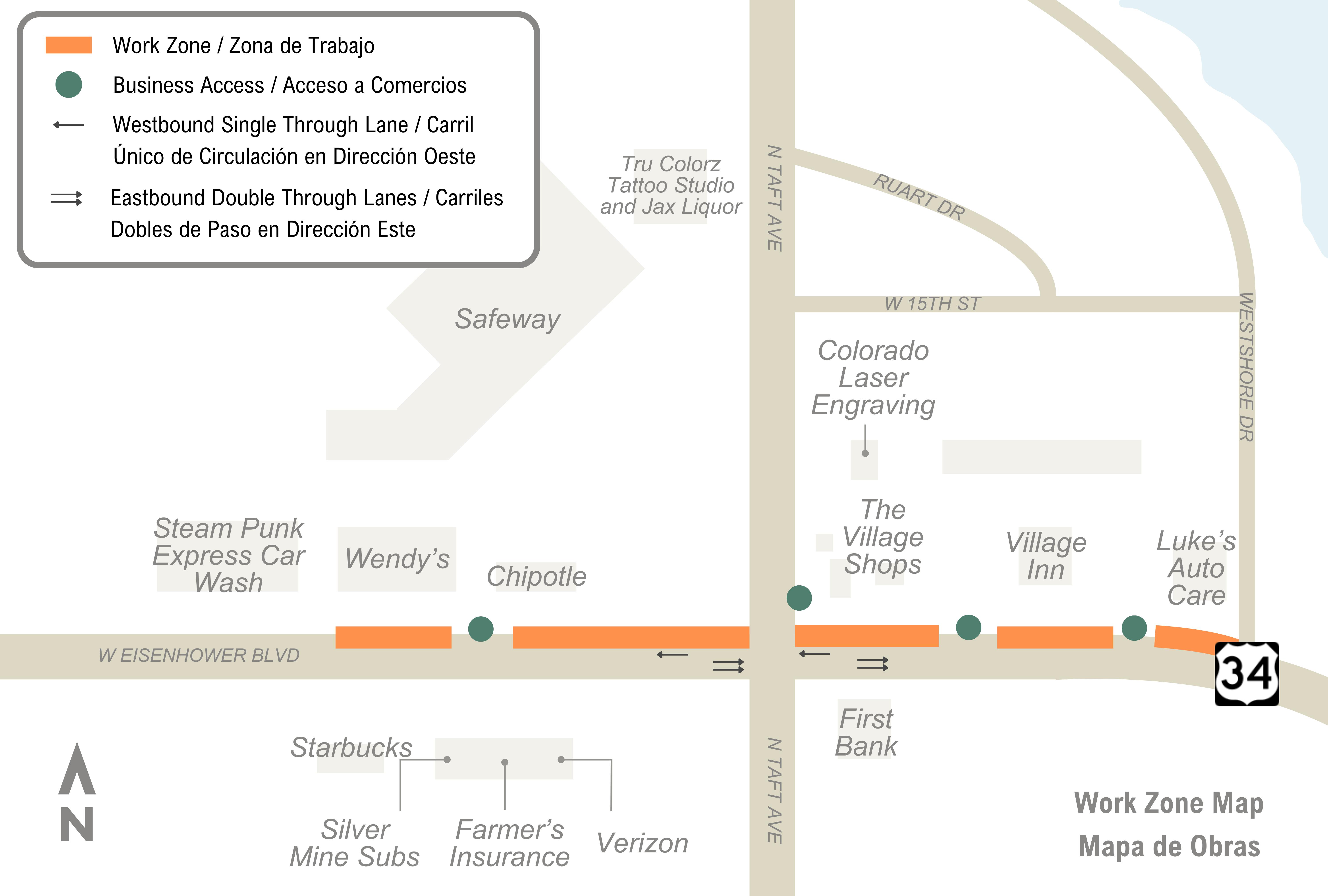
    During construction, we will work directly with the business owners in the area to ensure that exits/entrances for customers and vendors are always maintained. We understand construction is difficult. Our project team is committed to keeping these accesses maintained throughout construction. However, at times, there will be necessary adjustments, so work can be continued throughout the project. 

    Our team will also provide maps for the business owners to give an overview of the exits/entrances impacted throughout the project's four phases. Those deliverables will be shared with business owners and posted online soon. If you have any questions about the project's exits/entrances, please do not hesitate to contact our construction manager, Bonar Crump, at Bonar.Crump@cityofloveland.org or 970-962-2645. Thank you! 

  • Share What is the city going to do with the vacant land after the road improvements are done? on Facebook Share What is the city going to do with the vacant land after the road improvements are done? on Twitter Share What is the city going to do with the vacant land after the road improvements are done? on Linkedin Email What is the city going to do with the vacant land after the road improvements are done? link

    What is the city going to do with the vacant land after the road improvements are done?

    Glenn Chenot asked 10 months ago

    Hello, thank you for your question. After the project is fully completed, the City will be able to determine the outcome of the residual parcels. For additional questions inquiring about the land, please call the Public Works Transportation Engineering Division at 970-962-2524. Thank you! 

  • Share With the widening will there be a turn lane for 12th off Taft? There is a preschool off 12th and the amount of cars that almost rear end from texting or that quickly cut to the left hand lane to avoid slowing is staggering. It seems that intersection is quite a problem area with low visibility from over grown trees and no turn or merge lanes and impatient drivers on Taft. Two weekends ago I even witnessed yet another crash at that intersection. Turn lane can help with through traffic and prevent congestion into the intersection of Taft and 34. on Facebook Share With the widening will there be a turn lane for 12th off Taft? There is a preschool off 12th and the amount of cars that almost rear end from texting or that quickly cut to the left hand lane to avoid slowing is staggering. It seems that intersection is quite a problem area with low visibility from over grown trees and no turn or merge lanes and impatient drivers on Taft. Two weekends ago I even witnessed yet another crash at that intersection. Turn lane can help with through traffic and prevent congestion into the intersection of Taft and 34. on Twitter Share With the widening will there be a turn lane for 12th off Taft? There is a preschool off 12th and the amount of cars that almost rear end from texting or that quickly cut to the left hand lane to avoid slowing is staggering. It seems that intersection is quite a problem area with low visibility from over grown trees and no turn or merge lanes and impatient drivers on Taft. Two weekends ago I even witnessed yet another crash at that intersection. Turn lane can help with through traffic and prevent congestion into the intersection of Taft and 34. on Linkedin Email With the widening will there be a turn lane for 12th off Taft? There is a preschool off 12th and the amount of cars that almost rear end from texting or that quickly cut to the left hand lane to avoid slowing is staggering. It seems that intersection is quite a problem area with low visibility from over grown trees and no turn or merge lanes and impatient drivers on Taft. Two weekends ago I even witnessed yet another crash at that intersection. Turn lane can help with through traffic and prevent congestion into the intersection of Taft and 34. link

    With the widening will there be a turn lane for 12th off Taft? There is a preschool off 12th and the amount of cars that almost rear end from texting or that quickly cut to the left hand lane to avoid slowing is staggering. It seems that intersection is quite a problem area with low visibility from over grown trees and no turn or merge lanes and impatient drivers on Taft. Two weekends ago I even witnessed yet another crash at that intersection. Turn lane can help with through traffic and prevent congestion into the intersection of Taft and 34.

    AMedlin asked 10 months ago

    Hello, thank you for your question! The Taft Avenue and US 34 widening plans include northbound and southbound left turn lanes and a southbound right turn lane at Taft/12th/Loch Mount. Our Traffic Operations team will be looking into the overgrown trees you identified. If you have questions for our Traffic Operations division, you may reach them at 970-962-2524 or through our online Traffic intake form here: https://www.lovgov.org/services/public-works/traffic-operations/report-a-traffic-concern. Thank you! 


Page last updated: 30 Aug 2024, 04:35 PM