Skip To

  • Skip to content
  • Jump to navigation
  • Search

Page Outlines

Loading...

    Globe

    IE10 and below are not supported.

    Google Chrome Mozilla Firefox

    Contact us for any help on browser support

    Intersection of US 34 and Taft Avenue

    You are here:

    • Home
    • US 34 and Taft Avenue Intersection Improvement Project

    Photos

    Pedestrian Detour Map for Phase 3b
    previous next
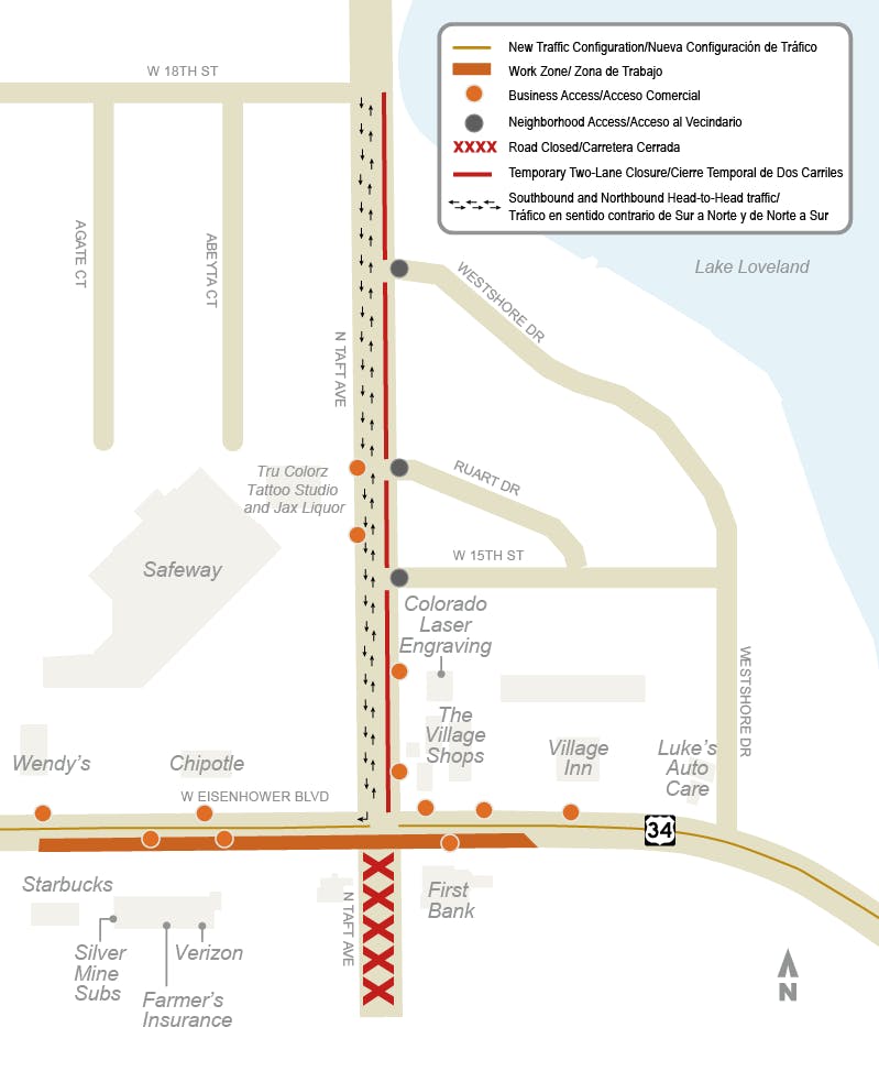
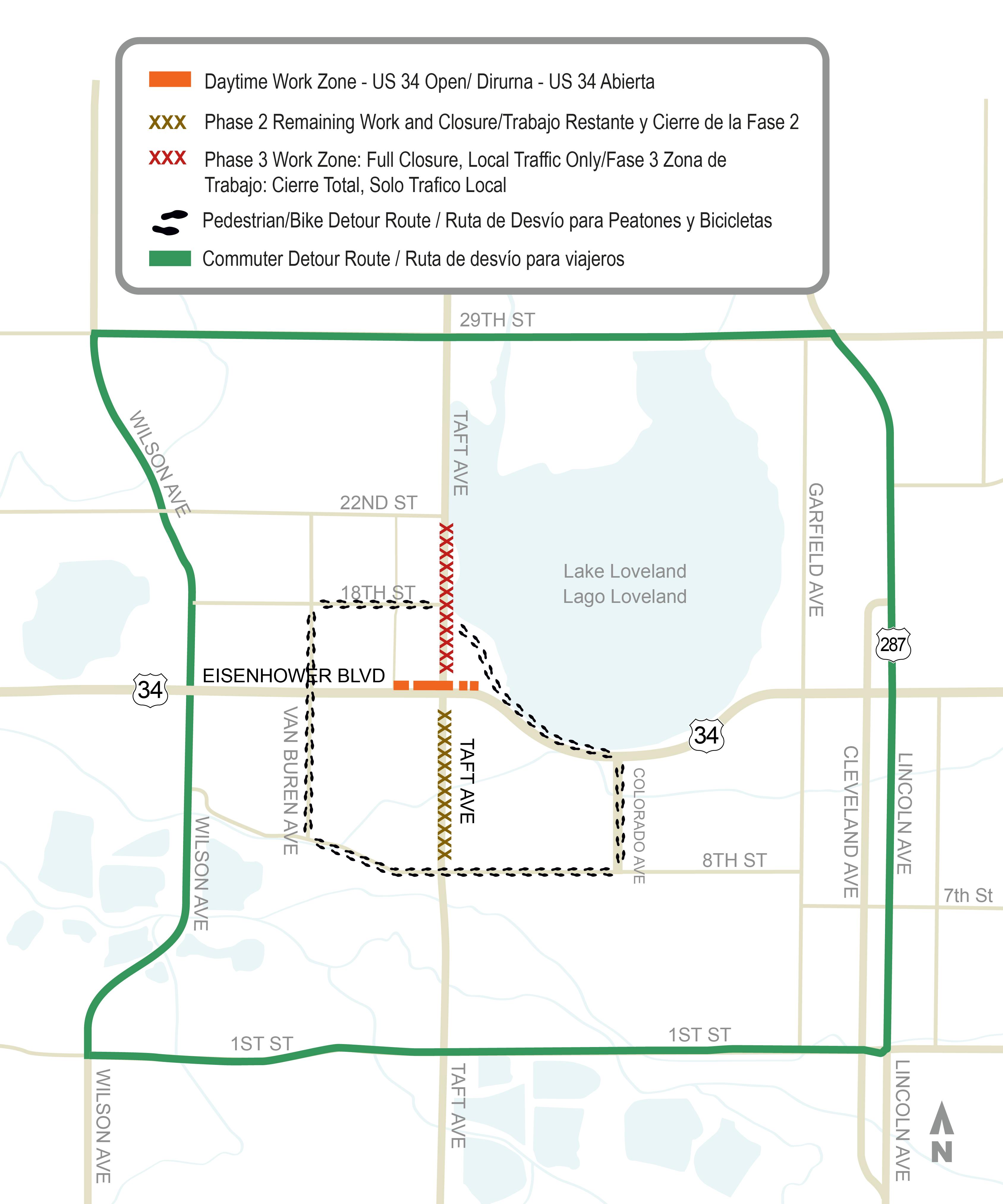
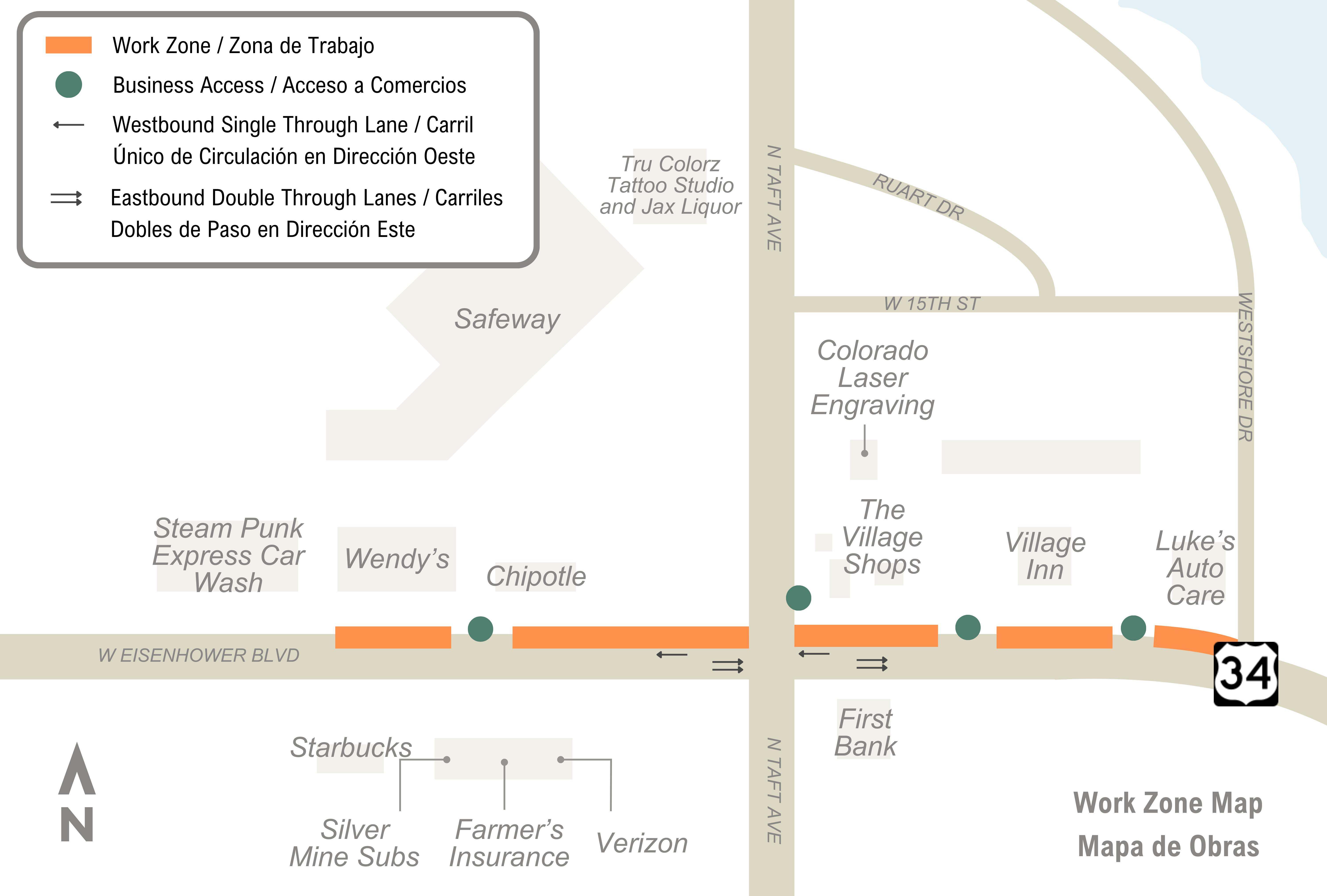
    Pedestrians are recommended to use N. Taft Avenue then head west on 18th Street then south on Van Buren Avenue, and then east on Highway 34/Eisenhower Boulevard. Alternatively, from US 34/Eisenhower Boulevard, pedestrians will head south on N. Taft Avenue, east on 8th Street, north on Colorado Avenue, and west on US 34/Eisenhower Boulevard to Westshore Drive.
    April 24 open house with residents and business owners surrounding a plot plan.
    Project engineers discuss utility and road improvements with residents at the April 24 open house.
    Residents surround a plot plan and discuss their questions with Acting Economic Development Director Marcie Willard.
    A full Phase 3 map of  the upcoming work starting Monday, Nov. 4, weather permitting.
    Phase 3b Work Zone Map
    US 34 and Taft Avenue Intersection Improvement Final Design
    Pedestrian Detour Map for Phase 3b
    US34 and Taft Avenue Intersection Improvement Project - Phase 2 Completion
    May 12 - 13 US 34 Concrete Work
    Phase 4 map starting on June 9
    Phase 4 map starting on June 26
    US 34 and Taft Avenue Intersection Improvement Project - October 2023